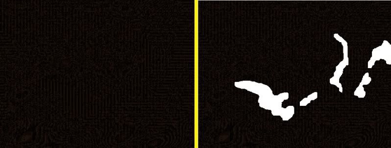
Now as you can see the areas where there is only background
(Smooth lines) are the clouds and the rest is topographic land.
Of course you can reverse and make all the clouds land
and the topographic land clouds...
I was looking at some satellite maps and it looks like my scale is
about 1/2 mile
or 2500 feet above the surface, maybe a square mile...
And on some maps it looks to be 60 square miles...Like over all of Los
Angeles.
Yes it does look like a modern doppler image to show where the rain is
actually falling and the white cut outs are those spots of actual
rainfall.
Here's a good topographic symbolic representation
to use to explain the squiggles that arn't clouds...
_____________________________________________________________
Open any .JPG image (your saved image from my program, Clouds5.exe)
Click radio button FREE DRAW / ERASER
Trace around the cloud area, don't overlap trace too much.
Click radio button DOUBLE CLICK the desired color
Double click inside the traced area and it all disappears.
There is an undo and redo
to save do a screen capture because the free version
won't let you save the result
________________________________________________________________
Source code available on request ;)
![]()